≡ Menu

Last September when we sailed on Holland America’s 7-Day Canada and New England Discovery cruise on the ms Rotterdam, we visited Sydney on Cape Breton Island.

Holland America Rotterdam in the port of Sydney, Cape Breton, CanadaThis cruise port is famous for having the world’s largest fiddle. (Look close and you can see it in the photo above.) Sydney is a relatively small town that we’d visited several times before, so I was looking forward to exploring more of Cape Breton Island.
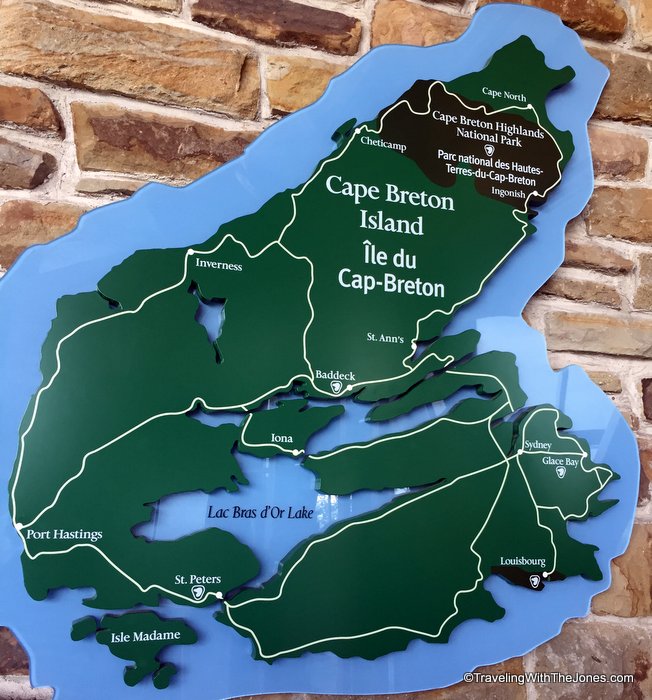
map of Cape Breton Island, Nova Scotia, CanadaI booked Holland America’s “Baddeck On Your Own” shore excursion, which transports you from the port of Sydney to the resort town of Baddeck. It is about a 75-minute drive, during which which the guide shared interesting commentary about the history of Sydney and of Cape Breton Island.
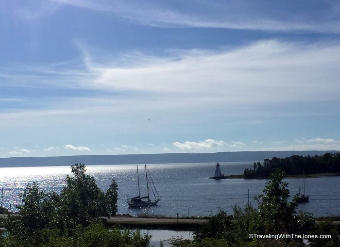
Bras d’Or Lake at Baddecl, Cape Breton Island, Nova Scotia, CanadaAs you get close to Baddeck, the views of the Bras d’Or Lake are spectacular.  One of the world’s largest saltwater tidal lakes, Bras d’Or Lake covers 425 square miles at the center of Cape Breton Island.  The village of Baddeck is situated on the lake’s northern shore.
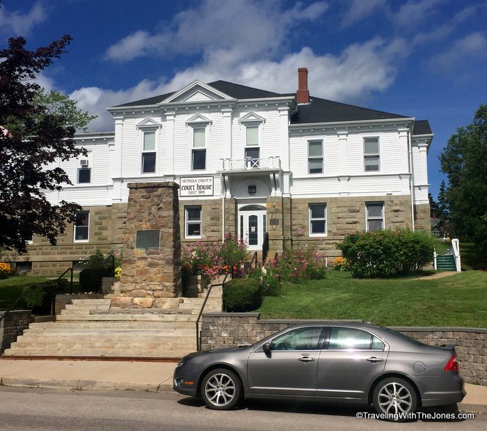
Victoria County courthouse, Baddeck, Cape Breton Island, Nova Scotia, CanadaA village of 769 residents, Baddeck is the county seat for Victoria County, Nova Scotia, Canada.
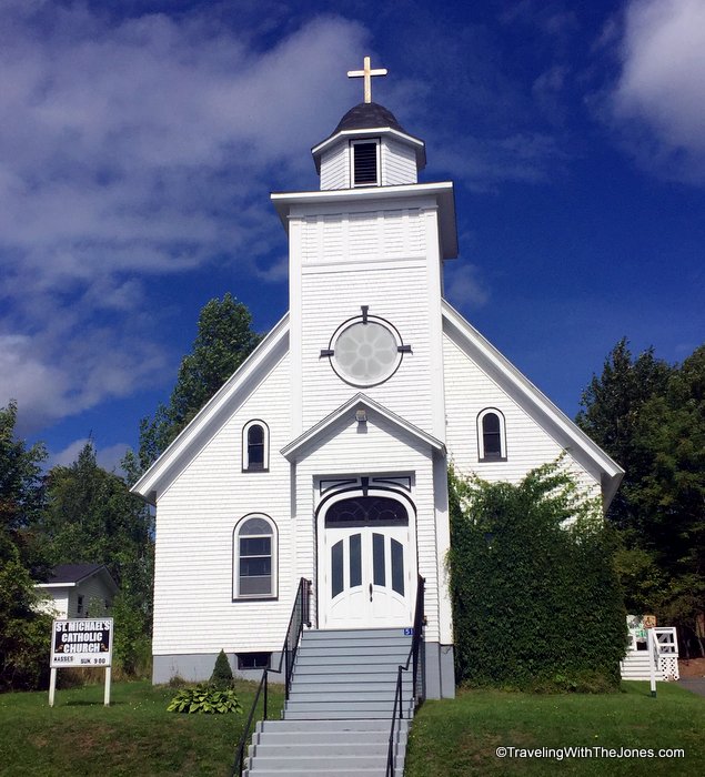
St. Michael's Church, Baddeck, Cape Breton Island, CanadaBaddeck is the perfect size for walking around to explore on your own. This shore excursion gives you about 3 hours in Baddeck, dropping off participants near the tourist information office. There are numerous shops and restaurants in this charming resort town.

"Bells at Baddeck" honors Mabel (Hubbard) Bell and Alexander Graham Bell, famous residents of Baddeck, Cape Breton Island, CanadaI started out by walking the lakefront path. The “Bells at Baddeck” sculpture honors Mabel (Hubbard) Bell and Alexander Graham Bell. In 1885, Bell — the inventor of the telephone –acquired land near Baddeck overlooking the Bras d’Or Lake. The area reminded him of his childhood years in Scotland.

Bell spent the last 32 years of his life in Baddeck, where he established a summer estate with research laboratories.
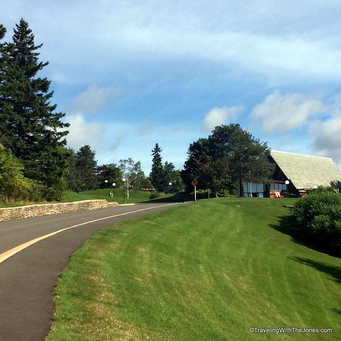
road to Alexander Graham Bell Museum, Baddeck, Cape Breton Island, Nova Scotia, CanadaI walked about a half a mile to this road just at the edge of town. It leads to the Alexander Graham Bell Museum.  (If this sounds like too much walking, Holland America also offers several other tours by bus that include a visit to this museum.)
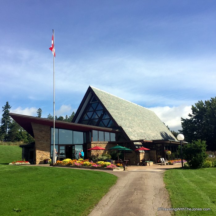
Alexander Graham Bell Museum, Baddeck, Cape Breton Island, Nova Scotia, CanadaThe Alexander Graham Bell Museum, a unit of Parks Canada, contains artifacts and documents from Bell’s years of experimental work in Baddeck.

At the museum, I was surprised to learn that Alexander Graham Bell was a life-long researcher and inventor. He established research laboratories in Baddeck where he continued to experiment on a diverse range of scientific endeavors including hydrofoil technologies, powered flight, sheep breeding and genetics among many others.

It was Bell’s work with the deaf, including his wife, that inspired him to invent the telephone. Helen Keller was a visitor to the Bell’s Baddeck estate.

Aviation pioneer John A.D. McCurdy at the controls of the AEA Silver Dart.

Aviation pioneer John A.D. McCurdy at the controls of the AEA Silver Dart.

Alexander Graham Bell also championed the inventiveness trait in other locals. In 1909, Baddeck native J.A.D. McCurdy manned the first Canadian flight above Baddeck Bay in the Silver Dart.

The Silver Dart (or Aerodrome #4) was a derivative of an early aircraft built by a Canadian/U.S. team at the Aerial Experiment Association (AEA), formed under the guidance of Alexander Graham Bell in Hammondsport, New York.

After the aircraft was successfully flown in Hammondsport, iy was dismantled and shipped to Baddeck. On February 23, 1909, the Silver Dart was flown off the ice of Baddeck Bay. This was the first controlled powered flight in Canada.

In 1910, McCurdy became the first Canadian to be issued a pilot’s license and the following year, he made the first flight from Florida to Cuba. In 1915, McCurdy established Canada’s first aviation school in Canada — the Curtiss Flying School. McCurdy was also the first manager of Long Branch Aerodrome, Canada’s first airport.

In addition to being a Canadian aviation pioneer, John Alexander Douglas McCurdy served as Nova Scotia’s 20th Lieutenant Governor from 1947 to 1952.

To learn more about Baddeck and Alexander Graham Bell, check out these resources:


Reluctant Genius: Alexander Graham Bell and the Passion for Invention


The Story of Alexander Graham Bell

For more on cruising in Canada and New England: 

Interact with us on TwitterFacebookPinterest or Instagram.

{ 0 comments }

We wanted to learn a little bit about Killybegs, Ireland before our June via the ms Prinsendam on the 14-day Celtic Explorer cruise.

Killybegs, Ireland Interesting Facts1. Killybegs is a port town of 1,297 people, located on the south coast of County Donegal.

Killybegs is Ireland's most important fishing port; its harbor is often full with trawlers. Photo by Andreas F. Borchert.

As Ireland’s most important fishing port, Killybegs harbor is often full with trawlers. Photo by Andreas F. Borchert.

2. Situated on a natural deepwater harbor, Killybegs is Ireland’s largest fishing port.

Example of a monk's

Example of a monk’s “cell” – this one is near Moville high cross, County Donegel, Ireland. Photo by Patrick Mackie.

3. The name Killybegs comes from the Gaelic or Irish “Na Cealla Beaga” that translates to “the little cells” — referring to the early settlement of monks in the area who lived in little stone “cell” dwellings. These monks, believed to be some the first settlers in the area, were responsible for dedicating a well in honor of St. Catherine of Alexandria.

St. Catherine's Well and Cat Castle on the hilltop in Killybegs, County Donegal, Ireland. Photo by Andreas F. Borchert.

St. Catherine’s Well and Cat Castle on the hilltop in Killybegs, County Donegal, Ireland. Photo by Andreas F. Borchert.

4. Saint Catherine is the patron saint of Killybegs — and the patron of all seafarers, confirming the long history of fishing and seagoing tradition for which the town and the surrounding region are famous. Visitors to Killybegs can see St Catherine’s Well on the west side of the town. Nearby are are the ruins of St Catherine’s Church, thought to go back to the 12th Century, that have been restored in recent years. 

5. In 1588, Killybegs was the last stop for La Girona, a ship in the Spanish Armada during Spain’s war with England. When two other Spanish ships were lost, the Girona anchored in Killybegs harbor, and local Chieftain MacSweeney Bannagh assisted in repairing the Girona’s rudder and feeding its sailors. While in Killybegs, the Girona took on-board 800 survivors from the other Spanish ships before setting sail for Scotland.

1588 Spanish Galleass Girona that last anchored in Killybegs Harbor. Art by Notafly.

1588 Spanish Galleass Girona that last anchored in Killybegs Harbor. Art by Notafly.

Caught in a gale storm off the Antrim coast of Northern Ireland, however, the Girona sank. Nearly 1,300 people died, with only nine survivors.

In 1967 – 1968, a team of Belgian divers recovered immense gold treasures from the Girona, off the Antrim Coast near Giants Causeway. Some of the recovered gold is on display at The Ulster Museum in Belfast, Northern Ireland.

Fishing trawler SO 716 Sheanne in Killybegs Harbor. Photo by Andreas F. Borchert.

Fishing trawler SO 716 Sheanne in Killybegs Harbor. Photo by Andreas F. Borchert.

6. Although it has suffered from a downturn in the Irish fishing industry, Killybegs is still a leading fishing and fish processing hub.  Freezer ships full of processed fish such as mackerel, herring, scad, and blue whiting are exported from Killybegs to markets in Africa, the Middle East and Europe.

Tread softly

7. Killybegs is famous for its tapestries and carpets, some of which were produced on the world’s biggest carpet loom at the Donegal Carpet Factory. At its peak, the factory employed 80 workers making Turkish-style, hand-knotted carpets known as “Donegals ” for prestigious buildings around the world including Buckingham Palace, the White House, and the Vatican.

While the factory in Killybegs closed in 2003, the building now houses the Killybegs International Carpet Making & Fishing Center, which offers tours and information on the carpet making and the fishing industry. The center also offers a modern ship simulator that allows both children and adults to test their navigation skills.

8. Visitors to Killybegs can get information and recommendations from locals by stopping into the Killybegs Information Center, which located on the Shore Road. The tourism organization for Killybegs offers detailed descriptions of local attractions, plus a map showing Suggested Looped Walks around Killybegs that you can download here.

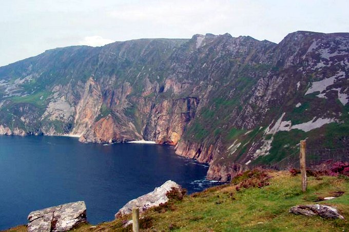
Sliabh Liag (Slieve League) cliffs in County Donegal, Ireland

Sliabh Liag (Slieve League) cliffs in County Donegal, Ireland

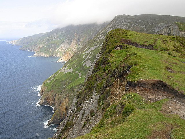
9. Killybegs is the ideal gateway to reach the Sliabh Liag cliffs. Rising to 1,972 feet, Sliabh Liag offers panoramic views across the horizon overlooking Donegal Bay, just 12 miles from Killybegs. These are some of the highest sea cliffs in Europe, nearly three times higher than the Cliffs of Moher in County Clare, Ireland.

Cliffs of Slieve League, County Donegal, IrelandVisitors not afraid of heights can try walking along ‘One Man’s Pass’ which takes hikers to the highest point of Sliabh Liag. There is also a visitor’s viewing platform for non-hikers to experience the views. It is also possible to view the cliffs from the sea via a Sliabh Liag boat ride.

This guidebook is helping us research and plan for our port calls in Ireland:

DK Eyewitness Travel Guide Ireland

Have you visited Killybegs? What fun fact can you add?

Interact with us on TwitterFacebookPinterest or Instagram.

{ 0 comments }

View of One World Trade Center from the cemetery of St. Paul's ChapelWe spent a lovely day on Sunday walking around New York City. The sky was blue with bright sun, the temperature was comfortable, and the springtime ‘bloom’ was in full force.

Best of all, we learned some new things about New York, and got a significant amount of exercise, which helped justify all of the terrific food we consumed. Even though we took several subway rides, my FitBit showed that we walked 18,449 steps over 8.78 miles.

Bowling Green park, Financial District, New York CityIn Lower Manhattan, as we walked from the waterfront to the southern end of Broadway, we discovered Bowling Green Park. This small park in the Financial District was built in 1733, by the original New Amsterdam Dutch fort.

Bowling Green is New York City’s oldest public park and is surrounded by its original 18th-century fence.

tulips in Bowling Green park, Lower Manhattan Financial District, New York CityThe park originally included a bowling green — an area of short-clipped grass for lawn bowling. Today the park features a ring of gorgeous red tulips, and benches for taking a relaxing nature break in an area surrounded by high rise buildings of the Financial District.

'Fearless Girl' sculpture, Financial District, New York CityWhile the Bowling Green was peaceful, there were crowds of tourists surrounding the iconic “Charging Bull” sculpture just north of the park. The crowd was also checking out the recently-added “Fearless Girl” sculpture that is staring down the Wall Street bull.

This statue was installed in March, 2017 by State Street Global Advisors to celebrate and promote the firm’s “Gender Diversity Index” fund.  Originally given a one-week permit, Fearless Girl will remain in place through February, 2018.

We continued to walk up Broadway, a road that runs 13 miles from State Street at Bowling Green through Manhattan, then two miles through the Bronx, followed by 18 miles north through Yonkers, Dobbs Ferry and Tarrytown before terminating in Westchester County north of Sleepy Hollow.

cemetery outside Trinity Church Wall Street, New York City Broadway is the oldest north–south thoroughfare in New York City, dating to the first Dutch settlement. We were intrigued by the cemetery outside Trinity Church Wall Street. Alexander Hamilton is buried here, but the most imposing tomb is a fifteen-foot-high bronze sculpture of John Watts.  “Who was he?” we wondered.

John Watts Jr. was born in Manhattan in 1749. He was a lawyer and politician who represented New York in the U.S. House of Representatives, but he most-lasting legacy was that he founded and endowed the Leake and Watts Orphan House with the inheritance from distant relative and friend John G. Leake.  The effort continues today as Leake and Watts Services, a non-profit agency providing a range of services for New York City children and families.

One World Trade Center and St. Paul's Chapel, New York CityContinuing north up Broadway, we saw the juxtaposition of the old and the new: the One World Trade Center and St. Paul’s Chapel.  Rebuilt after the September 11, 2001 terrorist attacks, One World Trade Center’s antenna/spire reaches 1,776 feet to symbolize the year when the U.S. Declaration of Independence was signed.

St. Paul’s Chapel first opened in 1766 as a “chapel-of-ease” for those who did not want to walk on unpaved streets to Trinity Church. While the Great Fire of 1776 destroyed the first Trinity Church, St. Paul’s survived, thanks to residents dousing the building with water via a ‘bucket brigade.’ Many early New York residents made St. Paul’s their church home including George Washington. On April 30, 1789, after he took the oath of office, President George Washington attended services at St. Paul’s Chapel.

Though the World Trade Center buildings across the street were destroyed by the 9/11 terrorist attacks, there was no damage to St. Paul’s. “The little chapel that stood” became the relief ministry to rescue and recovery workers for nine months. Displays inside St. Paul’s detail how workers rested on the church benches during the intense recovery efforts.

St. Paul's Chapel and cemetery, Financial District, New York City In the cemetery behind St. Paul’s Chapel, the graves date to the 1700s. Signs explain the Chapel’s role throughout the city of New York’s history.

The Millenium Hilton hotel is across the street from St. Paul's Chapel cemetery in New York City near the World Trade CenterFrom the cemetery at St. Paul’s, we could see The Millenium Hilton hotel across the street. That triggered many 9/11 memories for us as we were scheduled to stay at this hotel in early October, 2011, before a cruise out of New York City. (The cruise was switched to a Boston departure; while we’ve since returned to New York City many times, we’ve never stayed at this hotel.)

We continued our exploration of New York through City Hall and various other points. Eventually, we returned to a favorite walking place in the city – the High Line Park.

The High Line, New York City While we loved the High Line when we first visited it in August, 2012, we found the April weather in New York City more ideal for enjoying this elevated walkway park.

The High Line Park, New York City Re-purposing of the abandoned, elevated railway into an urban park is such a lovely, brilliant idea. We love the High Line, where there is always something new or different to enjoy.

While our weekend in New York City went by too quickly, we’ve found these books to read before our next visit, so we can continue to explore while walking:

Magnetic City: A Walking Companion to New York


The Historical Atlas of New York City, Third Edition: A Visual Celebration of 400 Years of New York City’s History


The New York Nobody Knows: Walking 6,000 Miles in the City

Do you have a favorite park of New York City to explore? 

Interact with us on TwitterFacebookPinterest or Instagram.

Check out these other posts on exploring via a walk: 

{ 0 comments }

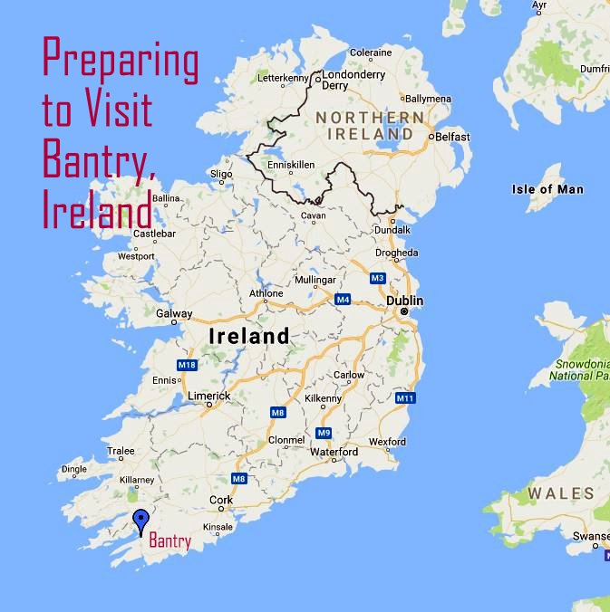
In early June we plan to visit the coastal town of Bantry, Ireland via a 14-day Celtic Explorer cruise. Since it is a new destination for us, we investigated this part of West County Cork.

Preparing to visit, Bantry, Ireland

The town of Bantry – with a population of less than 3,500 — is located at the head of Bantry Bay, a deep water, wind-sheltered harbor on the Atlantic Ocean. This bay has attracted fishermen, merchant ships and warriors for centuries.

A view overlooking part of Bantry, Ireland. Photo by Pam Brophy.

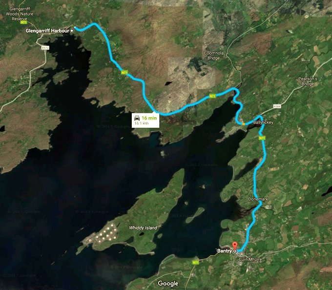
Bantry is a tender port for cruise ships. While researching this port, I learned that our cruise ship — Holland America’s ms Prinsendam —  will anchor off Glengarriff Harbor, and the ship’s tender boats will deliver us into the town on Glengarriff rather than into the town of Bantry. While this is a common situation, normally the port call would be marketed as Glengarriff (Bantry), Ireland, rather than simply as Bantry, Ireland.

Google map of Glengarriff Harbor

According to Google Maps, it is a 10-mile, 16-minute drive from Glengarriff Harbor to the town of Bantry. We will have to figure out how to get to Bantry from where our ship’s tenders drop us off. We downloaded the Journey Planner travel app for Ireland to check public transportation between Glengarriff Harbor and Bantry. (The TFI Journey Planner is free, and available from the Apple App store, Google Play or the Windows store. The public bus service between the towns appears to be infrequent on the day of our visit, and it doesn’t appear that Uber has made it to Glengarriff or Bantry.

Once we arrive in Bantry, we will most likely stop by the Bantry Tourist Office for maps, directions and a few questions best asked from a local. It’s located in the Old Courthouse by the Wolf Tone Square (the main square in central Bantry.)

Based on our pre-trip research, these are the things around the town of Bantry and Bantry Bay that we’d like to explore.

8 Things to Do While Visiting Bantry, Ireland

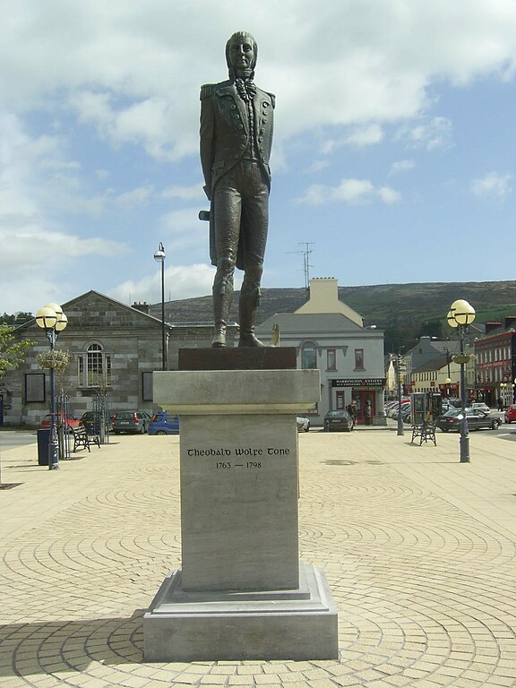
A statue of Theobald Wolfe Tone also stands in the main square of Bantry, Ireland.

1.  Stop by the Theobald Wolfe Tone statute in Bantry’s main square. The square commemorates Dublin-born Theobald Wolfe Tone. Tone led the United Irishmen in an uprising against British rule in Ireland. The United Irishmen, a republican revolutionary group influenced by the ideas of the American and French revolutions, were the main organization behind the Irish Rebellion May to September 1798.

2. Get a latte and a scone or a sausage roll at the Box of Frogs Coffeehouse & Bakery. This highly-rated cafe is located at Bridewell Lane in Bantry. Who can resist a latte dusted with chocolate in the outline of a frog?

map of the Heritage Loop Walks in Bantry, Ireland. Map from Explore West Cork /West Cork People.

3. Take one or all of Bantry’s Heritage Loop Walks – perhaps starting with the Béicín Loop – described as “a short walk on a concrete pathway by the sea, easily accessible from the town center. Wonderful views of Bantry Bay, mountains, and islands in the bay.”  Trail descriptions and map can be accessed at Explore West Cork.

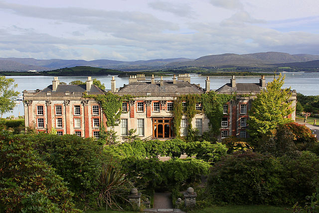
The Bantry House is located on the south side of Bantry Bay near the town of Bantry, Ireland. Photo by Jörg Bittner Unna.

4. Visit the Bantry House and Gardens – the ancestral home of the White family who became the Earls of Bantry. While still owned by  descendants of the White family who still live on the property, tourists can visit the estate.  The house has a collection of artworks gathered by the second Earl of Bantry and his wife Mary as they traveled across Europe. Their travels also inspired the Bantry House gardens.

The house has been open to tourism since 1946, and offers tours of the house and gardens, a tea shop and bed and breakfast accommodations.

5. Check out the 1796 Bantry French Armada Center  – next to the Bantry House. This center recounts the story of Theobald Wolfe Tone and the United Irishmen’s attempt to land a 50-ship French Armada in Bantry Bay in order to expel the British and establish an Irish Republic. Due to bad weather and other factors, the attack failed. The Armada Center recounts the attempted French landing and contains items excavated from the wreck in Bantry Bay as well as a 1-to-6 scale model of ‘The Surveillante‘.

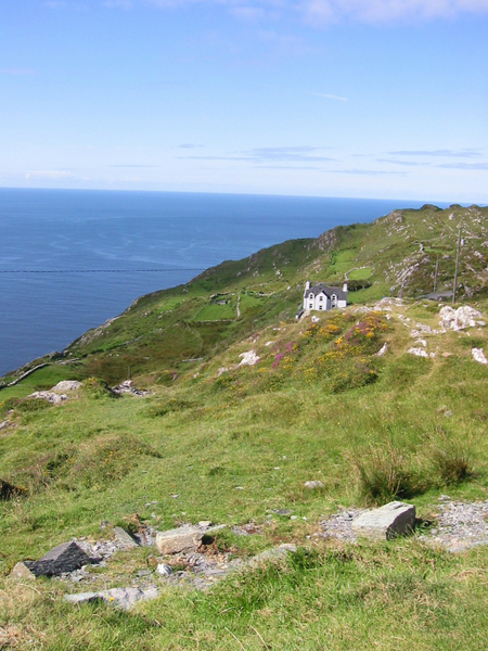
Sheep's Head near Bantry, County Cork, Ireland. Photo by Petra15.
Sheep’s Head near Bantry, County Cork, Ireland. Photo by Petra15.

6. Explore Sheep’s Head Peninsula – via a hike or renting a car to drive on the narrow 1-way road. This is a guide to the Sheep’s Head Looped Walks. The 4 kilometer or about 2.5 mile long Lighthouse Loop is rated moderate and might be interesting on a nice day. Other trails offer stunning scenery, but may be too adventurous for a day in port unless we hire a knowledgeable local guide and pack hiking boots.

7. Enjoy some local seafood. While the vast shoals of Pilchards found in the bay drew the English to Bantry in the 1600’s, today the area in known for mussel farming. We’d like a chance to sample the seafood at either The Fish Kitchen (above a fish shop, features locally sourced seafood, known for its daily specials) or O’Connor’s Seafood Restaurant where we’d have to try the Mussels in a Thai coconut curry sauce.

8. Drink a pint in a local pub. The more unique the name, the better. These pubs are on our list to check out while in Bantry: The Snug, The Quay’s Bar and Ma Murphy’s.

During our planning, we are using these two guidebooks:

DK Eyewitness Travel Guide Ireland

Rick Steves Best of Ireland

Have you visited Bantry, Ireland? What activities do you recommend?

Interact with us on TwitterFacebookPinterest or Instagram.

{ 0 comments }