In recent decades, Cape Breton Island, part of the Canadian province of Nova Scotia, has developed a significant tourism industry. We’ve visited this island several times via a cruise ship call at the port of Sydney, and wanted to learn more.
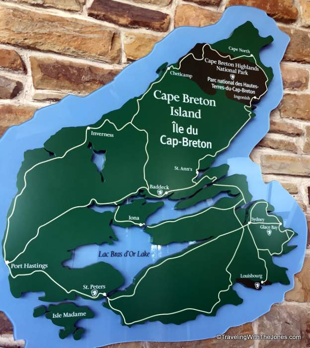
30 Fun Facts About Cape Breton Island, Nova Scotia, Canada
1. Cape Breton Island is the northeastern portion of Nova Scotia, Canada’s second smallest province. The island covers 3,981 square miles and has a population of 135,974 (as of 2011.) “Cape Bretoners” or “Capers” make up about 15 percent of the provincial population of Nova Scotia.
2. The 110-mile-long island is mostly hilly and forested, rising to 1,745 feet above sea level at the Cape Breton Highlands.
3. Bras d’Or Lake, one of the world’s largest saltwater tidal lakes, covers 425 square miles at the center of Cape Breton Island.
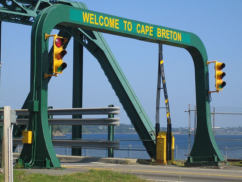 4. Cape Breton Island is separated from the rest of the Nova Scotia province and the Canadian mainland by 2-mile-wide Strait of Canso. A 130-ft wide, rock-filled Canso Causeway–constructed in 1955–allows two-way vehicle traffic and a single railway track to reach Cape Breton Island from the Nova Scotia peninsula.
5. Despite the Causeway, Cape Breton Island remains a true island thanks to the Canso Canal that allows ships to transit the Strait of Canso. A 308-ft swing bridge carries the road and railway line across the canal.
6. Cape Breton Island’s first residents were likely ancestors of the Mí’kmaq native people who were inhabiting the island at the time of European arrival.
7. Italian navigator and explorer John Cabot reportedly visited the island during his 1497-98 voyage. Although historians debate whether Cabot first visited Cape Breton Island or Newfoundland, Cabot’s discovery is commemorated on Cape Breton Island with Cabot Trail, a 185-mile scenic roadway around the northern part of the island.
8. The island — a French possession from 1632 to 1763 — was known as “Ile Royale” or Royal Island to the French.
9. “Ile Royale” grew in population after the 1713 Treaty of Utrecht under which France ceded it colonies on Newfoundland and the Acadian mainland to the British. The French population of Plaisance, Newfoundland relocated to Ile Royale.
10. Starting with a fishing settlement in 1713, the French constructed the Fortress of Louisbourg between 1720 and 1740. Known for exporting fish and cod-liver oil, Louisbourg became North America’s the third busiest port (after Boston and Philadelphia.)
11. British colonists captured the Fortress of Louisbourg in 1745, but it was returned to the French in exchange for European border towns (that are today a part of Belgium.)

British burning of the warship Prudent and capturing of the warship Bienfaisant during the 1758 Siege of Louisbourg. Engraving by Richard Paton, 1771.
12. During the Seven Years’ War, British forces once again captured Louisbourg in the Siege of Louisbourg which ended with a French surrender in 1758. The British then used the fortress as a launching point for its 1759 Siege of Quebec.
13. In 1760, British engineers systematically destroyed the fortifications at Louisbourg to prevent any future use of the town and port by the French. Some of the cut-stones from Louisbourg were shipped to Halifax to be re-used and, in the 1780s, to Sydney, Nova Scotia.
14. Starting in 1961, the Canadian government started a project to recreate 1740’s Louisbourg. The work required a team archaeologists, historians, engineers, and architects. The reconstruction was aided by unemployed Cape Breton coal miners who learned 1740’s French masonry techniques, and utilized as many original stones as possible.
15. Today, Parks Canada operates the Fortress of Louisbourg as a living history museum, attracting about 90,000 visitors per year.
16. Under The Treaty of Paris, also known as the Treaty of 1763, Ile Royale was formally ceded to the United Kingdom under the Treaty of Paris. The British attached Cape Breton to Nova Scotia and governed the island from Halifax.
17. In 1784 Cape Breton became a separate with British crown colony with Sydney as its capital and Joseph Frederick Wallet DesBarres as its first Lieutenant-Governor.
18. After the signing of the Treaty of Paris in 1783 to end the American Revolution, a number of Loyalist soldiers and civilians emigrated from New York City the Canadian colonies. Loyalist David Mathews, former Mayor of New York City, immigrated with his family to Cape Breton in 1783. Mathews served as interim administrator of Cape Breton colony between 1795 and 1798.
19. In 1820, the colony of Cape Breton Island was merged with Nova Scotia for the second time.
20. Between 1800 and 1850, during Scotland’s Highland Clearances, as many as 50,000 Highland Scots immigrated to Cape Breton Island. These immigrants brought traditional fiddle music with them from Scotland.

World’s largest fiddle, port of Sydney, on Cape Breton Island, Nova Scotia, Canada
21. Céilidhs (gatherings with musicians playing Gaelic folk music and dancing) are popular on Cape Breton Island. The Celtic Music Interpretive Center in Judique works to preserve and promote the traditional Celtic music on the island.
22. Cape Breton Island’s two major coal deposits drove much of its economy throughout the 19th and 20th centuries. The coal-mining and related steel mill industries tied to the Sydney Coal Field were the largest private employers in Canada from the late 1800’s until after World War II.
23. The coal-mining town of Glace Bay got its name from the annual drift ice (glace) in the Gulf of St. Lawrence. Major coal mining operations began in 1858 and continued into the 1980s. Glace Bay was also the hub of the Sydney & Louisburg Railway and a major fishing port. As its economically-feasible coal seams were exhausted, coal mining output declined rapidly during the 1960s. Today Glace Bay is home to a miners’ museum and a replica of a 19th-century miners’ village.
24. In 1885, telephone inventor Alexander Graham Bell acquired land on Cape Breton Island near Baddeck overlooking the Bras d’Or Lake. The area reminded him of his childhood years in Scotland. Bell established a summer estate with research laboratories, where he continued to experiment with hydrofoil technologies, powered flight, sheep breeding and numerous other scientific inventions. Helen Keller was a visitor.
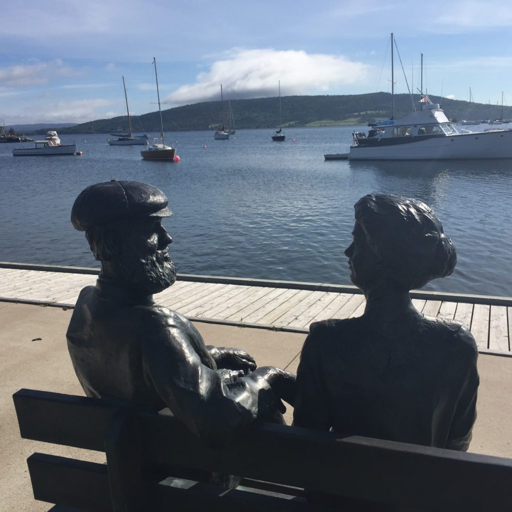
The “Bells at Baddeck” is a tribute to Mabel (Hubbard) Bell and Alexander Graham Bell in the village of Baddeck on Cape Breton Island in Nova Scotia, Canada.
25. Italian inventor and engineer Guglielmo Marconi, known for his pioneering work on long-distance radio transmission, used Cape Breton Island’s geography to his advantage. In 1902, he transmitted the first transatlantic wireless radio message from a station in Glace Bay to a receiving station in Cornwall, England.
26. The Royal Canadian Navy used Marconi’s Glace Bay station as its chief communications center during World War I and World War II. Today visitors can learn how Marconi’s work helped usher in the age of global communications at the Marconi National Historic Site in Glace Bay.
27. In 1995 Glace Bay lost its status as a town when it was combined with the city of Sydney and five other towns into the Cape Breton Regional Municipality (CBRM). Approximately 75% of the island’s population resides within the Cape Breton Regional Municipality.
28. In the 1890’s when a doctor ordered fresh air and rest for his ailing wife Julia, rubber industrialist Henry Clay Corson of Akron, Ohio bought land on Cape Breton Island at Ingonish. The Corsons built an opulent summer home that they christened Keltic Lodge. Her health recovered, Julia outlived her husband. In 1936 she sold the property to the Canadian government as it was creating the Cape Breton Highlands National Park nearby. The government turned Keltic Lodge into luxury resort and world-class golf course.

The main lodge of the historic Keltic Lodge in Ingonsish, on Cape Breton Island in Nova Scotia, Canada. Photo by Skeezix1000.
29. Open from June to October each year since 1940, the Keltic Lodge is adjacent to the 18-hole Highlands Links Golf Course, ranked as one of Canada’s best.
30. Five different cultures are found on Cape Breton Island: Scottish, English, Acadian, Irish and Mi’kmaq. English is the primary language, while Mi’kmaq, Scottish Gaelic and Acadian French are still spoken in some communities.
Read more about Cape Breton Island:

 Hiking Trails of Cape Breton, 2nd Edition

 The Oak Island Mystery, Solved

 The island of Cape Breton: its history, scenery and resources
What interesting fact can you add about Cape Breton Island? Please share in comments below, or interact with us on Twitter, Facebook, Pinterest or Instagram.
Check out these other fun facts posts:
 When we visited Taipei, Taiwan earlier this year, we had to do the thing most every tourist does: make a trip to the top of the 101-story skyscraper, located in Taipei’s Xinyi District.
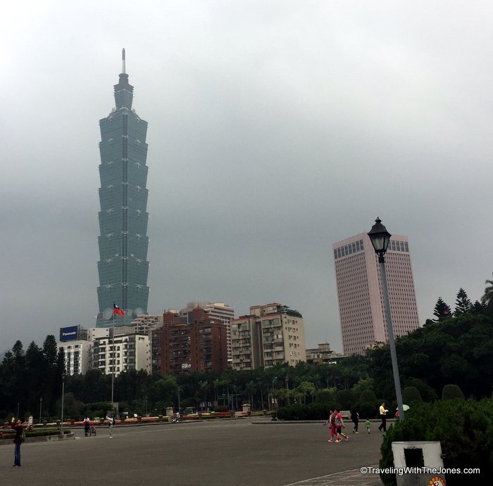 Taipei 101 dominates the landscape view most anywhere in the city of Taipei. The main tower of Taipei 101 features a series of eight segments with eight floors in each. While the repeated segments were designed to look like a stack of ancient Chinese money boxes, many U.S. visitors note the building resembles a stack of eight Chinese food take-out boxes.
 The easiest way to reach the tower is by taking the Red Line (Xinyi) Metro to the Taipei Metro Taipei 101/World Trade Center Station. From the Marriott Taipei, we took the MKT Brown Line (#1) from the Jiannan Road station to the Daan station, where we transferred to the Red Line (#2) heading toward to the Xiangshan station.
 Directions to the Taipei 101/ World Trade Center stop on the Red Line are well marked in English.
 When you get off of the Red Line subway at the Taipei 101/World Trade Center stop, you simply follow the signs to Taipei 101. Exit 4 connects directly to the basement of Taipei 101.
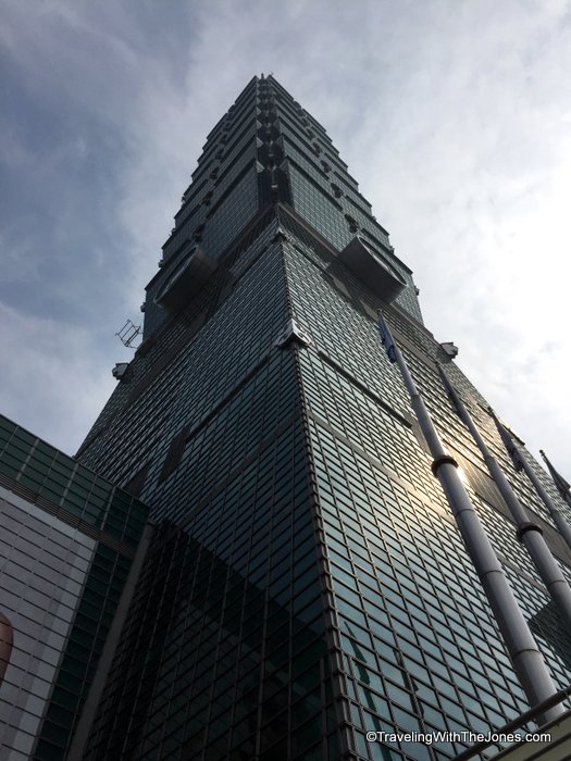 As you come outside from Exit 4, you have to look straight up for an up-close view of Taipei 101.
 Although the Taipei 101 Observatory is open daily from 9AM to 10PM, we followed the advice to go early. Arriving around 9:30am helped us avoid any long lines to buy tickets or to reach the Observatory.
 The Taipei 101 elevators take 37 seconds to whisk visitors from the fifth floor to the 89th-floor observatory.
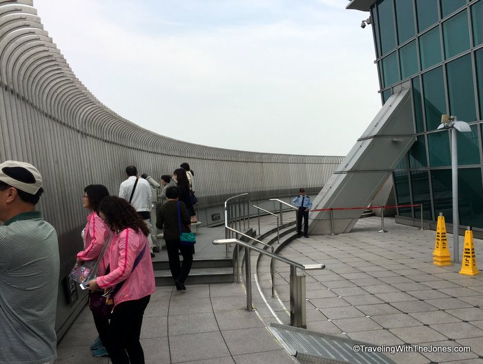 As long as the day is not too windy, visitors can take the stairs from the 89th floor to reach the outdoor observatory on Taipei 101’s 91st floor. The weather was overcast and hazy, so the views weren’t that great.
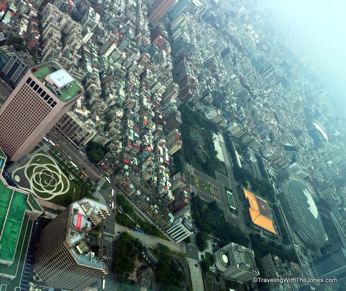 Still, the view looking down from the Taipei 101 observatory gives one a sense of just how high you are above the rest of the city of Taipei.
 We found the views of huge mass damper to be the most fascinating. This “damper” is designed to reduce the movement at the top of Taipei 101 by as much as 40 percent, key during times of high winds or earthquakes.
 The damper has a mascot: the Damper Baby, with its own comic book and website. Visitors can buy four versions of Damper Baby souvenirs in the Taipei 101 gift shops, although not as big as this one that is more than 6 feet, 6 inches tall.
  Our take on the best Taipei 101 souvenirs: mailing postcards from the 89th floor post box.


